The graphic territory of urbanism and its research potential
- Mar 6, 2025
- 2 min read
Expanding one's perspective is the daily exercise of architect and urban planner Carolina Passos, leader of urban planning projects, cartographer and specialist in data, planning and urban design.
Graduated from the Institute of Architecture and Urbanism of the University of São Paulo, in São Carlos, she completed a master's degree at the Polytechnic of Milan with a focus on urban projects and urban landscape, as well as improvement in environmental geoprocessing at UFSCAR (Federal University of São Carlos), working in areas of urban operations and urban plans, social housing and revitalization.
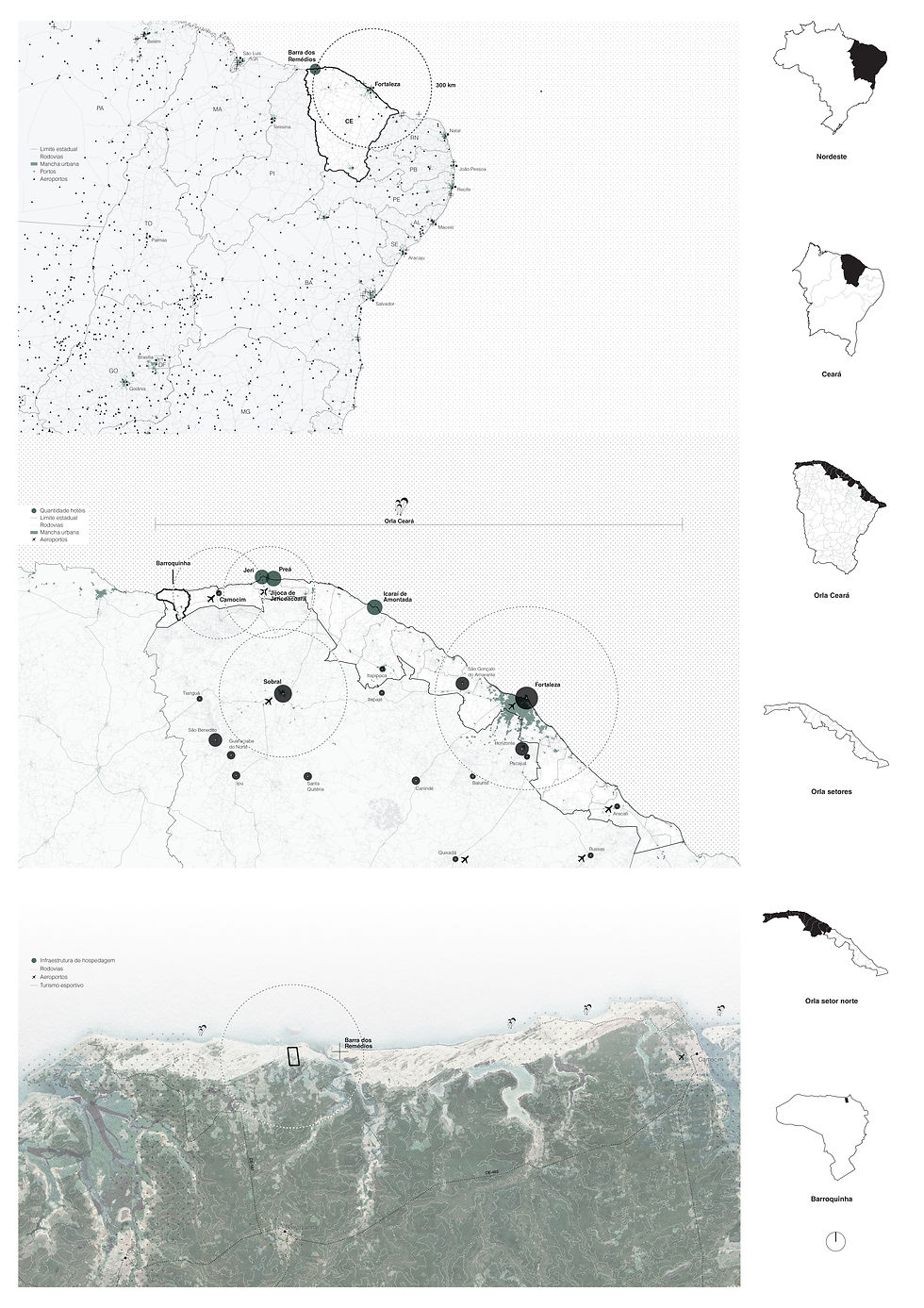
Cartography has come to be used as a tool to better understand data about the territory, facilitating analyses of the dynamics and trends of each location. These creations flirt a little with art, given the quality of the graphics, but they are functional, as they need to communicate important aspects.
"
Our challenge is to translate technical drawings,
that require specific knowledge to be interpreted, so that they can be quickly understood by anyone", says Carolina. It is worth using collages, increasingly realistic 3D images, sketches of multidimensional perspectives, as well as plans and diagrams. "Even when the architect does not have knowledge about how to use resources, he must be able to know where to find them and try to develop these skills", adds the architect.
The recent evolution of architecture is intrinsically linked to the emergence of new technology-based tools for creating, planning, measuring and designing. 3D and georeferencing software, combined with image editing, are resources that have become increasingly accessible and, therefore, essential for architecture and urban planning professionals to correctly express their ideas and defend their arguments.
Read also : With the exhibition "Possible Worlds", ARCHITECTS OFFICE explores new dimensions of architecture and design .
Whether presenting projects to clients, participating in public hearings or even debating issues with local communities, good visual tools are the most guaranteed way to contribute to understanding and fluid dialogue about proposals.
In the AO-SP team, Carolina consolidates the Urban Studies Center to increasingly bring this perspective of research and urban transformation to the country, which ends up becoming input for many projects.
"
It is part of our role as urban architects not to get stuck,
but we always look for cultural and geographical variables that make up our history and help with different perceptions", he states. "As AO has this strong research base in urban projects and sustainability, these factors end up being decisive for the development of architecture itself".
The importance of looking beyond the lot, understanding the context in which each project is inserted, is one of AO's main premises. Just like nature, each city is a living being in constant evolution. Thinking about the urban scale and its specific morphologies, composed of structures, forms and transformations, means being able to intervene in the most sensitive way possible, with the most pertinent and assertive short, medium and long-term results.
AO _masterplan featured in the media


